Assignments Based on NR 533 Topics
NR 533 - Application Issues in Geographic Information Systems
ArcGIS Model Builder
Model Builder is a powerful tool in the ArcGIS application suite. It allows a user to visually build and map a method workflow for a particular project. The model can then be stored for future use and allows for easy repetition of complex procedures saving a GIS user time and effort.
Conservation Analysis
For NR 533, we hade to complete several assignment that familiarized us with using the model builder tool. One such assignment was to evaluate the landscape in a 41-county area in southeastern North Carolina in terms of its conservation value. We used five ways to characterized the conservation value of the landscape:
- Land characteristics or inherent land suitability in relationship to farming
- Riparian plans that have already identified properties and watersheds of interest
- Proximity to land already conserved
- Environmental characteristics that are considered high-quality, outstanding, sensitive, or vulnerable
- Proximity to land that is densely populated, developed for residential or commercial purposes, or ready for development because of nearby primary roads or sewer lines
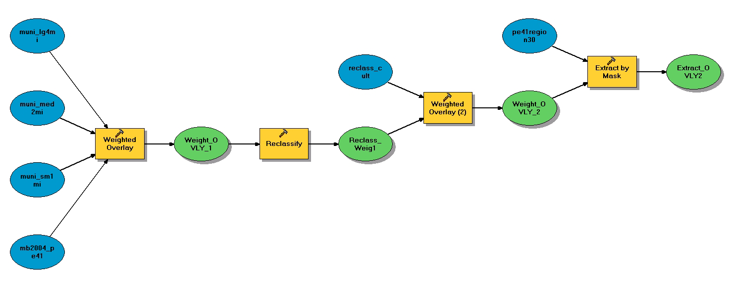
Model Builder workflow for this assignment.
Click the image to view the full-size version.
For this assignment, we used various municiple buffer layers and a farm suitability layer comboned with weighted overlay functions to determine areas of relative conservation value.
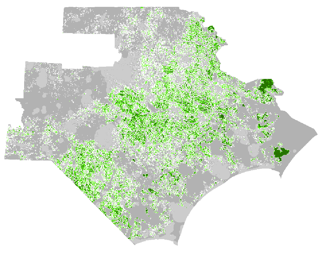
Areas of conservation value ranging from high (dark green) to low (light grey).
Click the image to view the full-size version.