Assignments Based on NR 533 Topics
NR 533 - Application Issues in Geographic Information Systems
Geodatabases and Database Structure
Databases are used to link related information tables to create a complex hierarchical structure for managing and retrieving information. ESRI has created a variety of tools to use databases to store geospatial information.
ER Diagrams
I developed an ER diagram, using the standard notation, for a University database used to track transcripts based on the following information:
- The university keeps track of each student’s name, student number, social security number, current address and phone number, permanent address and phone number, birth date, sex, class (freshman, sophomore, etc.), major department, minor department, and degree program (B.S., B.A., etc.) Some linked applications require information regarding the city, state, and zip code of the student’s addresses. Other applications require first name, middle initial, and last name information. Both social security number and student number have unique values.
- Each department is described by a name, department code, office number, office phone, and college. Both name and code are unique to each department.
- Each course has a course name, description, course number, number of semester hours, level, and offering department. The course number is unique for each course.
- Each section has an instructor, semester, year, course, and section number. The section number distinguishes sections of the same course that are taught during the same semester/year (values are 1, 2, 3, up to the number of sections offered in a semester).
- A grade report has a student, section, letter grade, and numeric grade (0, 1, 2, 3, or 4).

ER Diagram for University Database Design Exercise
Click Image to view full-size
new paragraph
Personal Geodatabase Creation
Using a provided shapefile and Access database with no defined relationships, we constructed a personal geodatabase.
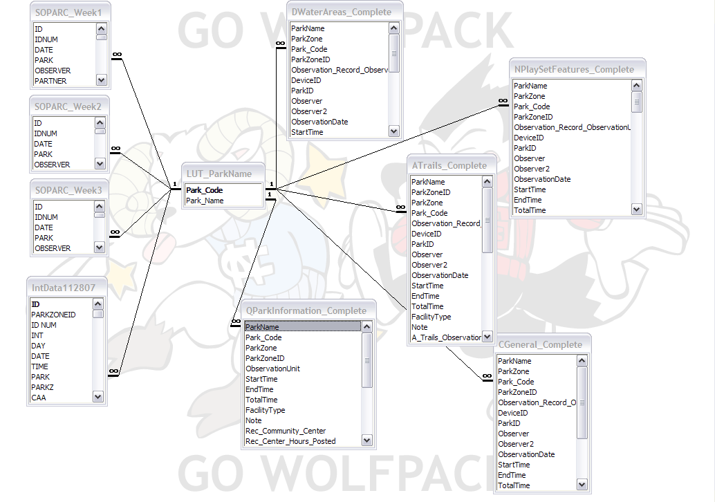
ER Diagram for Personal Geodatabase Exercise
Click Image to view full-size
Step of personal geodatabase construction:
- Plan out database relationships in Access
- Create new personal geodatabase in ArcCatalogue
- Make a new feature class in a new feature dataset using a shapefile for the input features
- Register original database
- Open personal geodatabase in Access and insert linked tables from original database
- Register linked tables in new geodatabase
- Define table relationships in Arc Catalogue