Assignments Based on NR 531 Topics
NR 531 - Introduction to Geographic Information Science
NR 531 is the first course in the core Geographic Information Systems (GIS) series and is an overview of the operations and functions of computerized spatial display and map analysis processes (Geographic Information Systems), production of effective computer-generated maps and spatial displays, concepts for spatial modeling.
The course covered the following topics:
- Introduction to ESRI products
- Common data types and formats
- Introduction to map scale, projection, and coordinate systems
- Basic geospatial analysis
- Georegistration
The following examples are a subset of the class work that shows the various topics covered:
Schenck Forest Soils
Color soil polygons based on soil type
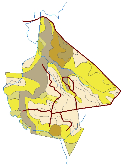
Click image to view full-size
NCSU Recreational Facilities
Create polygons with labels to denote outdoor recreational facilities in the orthophoto of NCSU campus.
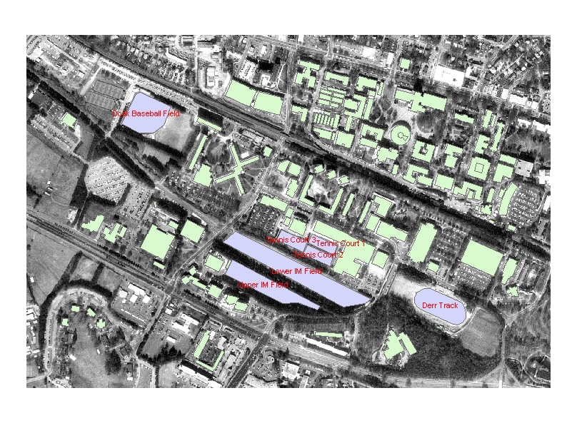
Click image to view full-size
Denote Toxins Sample Sites by Location Characteristics
Color code toxin sample sites by location type (sounds, ocean, island, etc...)
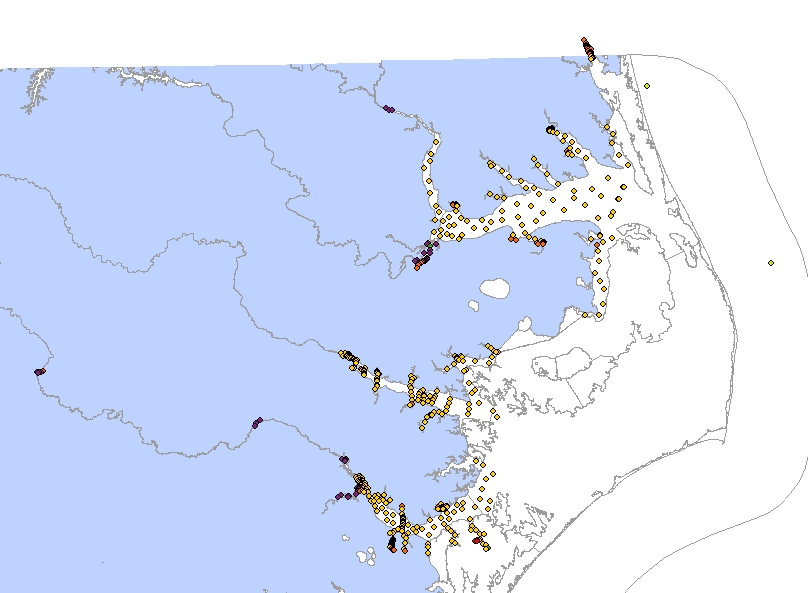
Click image to view full-size
Identify Potential Antenna Locations
Identify potential antenna location sites based on road proximity, pre-existing facilities, location inside municipal boundaries, etc...
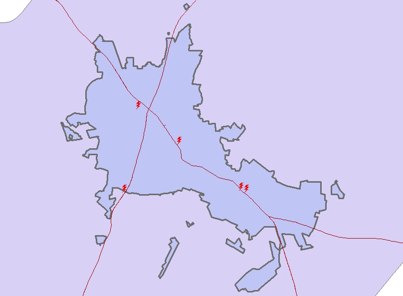
Click image to view full-size
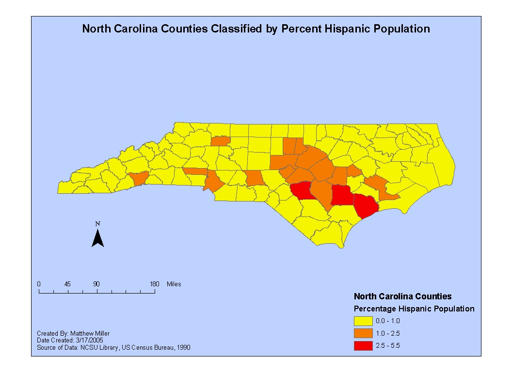
Classify Counties by Hispanic Population Percentage
Calculate the percentage of county population that is hispanic and then color code counties according to that percentage
Click image to view full-size
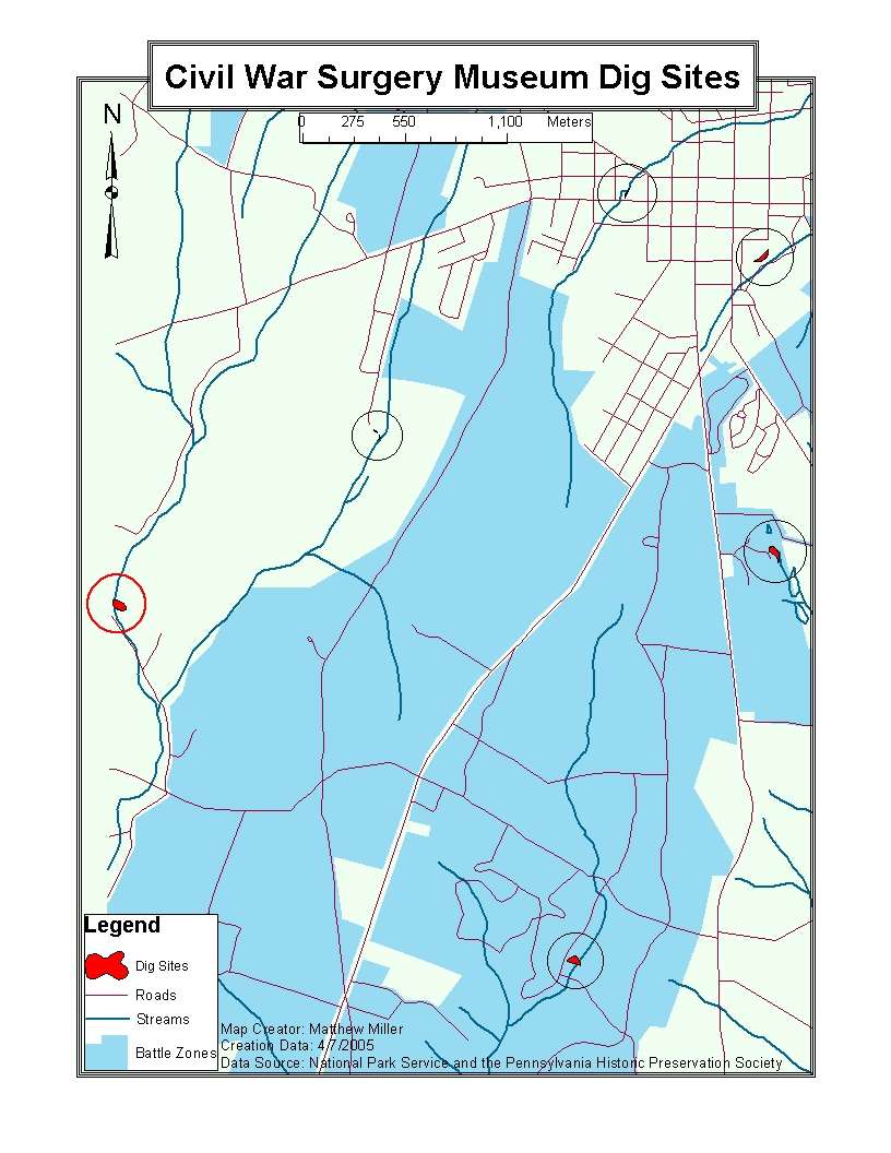
Potential Museum/Archeological Dig Sites
Based ground slope, and proximity to historical residential areas, battle zones, streams, roads, and previous archeological finds identify potential locations for a Civil War Surgery Museum and Archeological dig site.
Click image to view full-size