NR 535 Assignments
NR 535 - Computer Cartography
Project 2 - Map Design for Poster Presentation
A common event at professional meetings and conferences is the poster session, where topics are presented and discussed in an informal setting. The means of visual communication is the technical poster -- a large format graphical presentation which describes a specific scientific or technical issue, or research effort. The technical poster combines maps, explanatory text, and ancillary graphics such as charts, diagrams, and illustrations in conveying its message. Successful poster design requires clear communication through all elements of the poster, but also the effective organization of these diverse elements into a coherent presentation.
Specifications
The object of this assignment is to create a cartographic 'mini-poster' which might serve as the initial design for a larger format presentation at a professional conference or meeting. In addition to your main map, your poster should contain at least one other graphical component (another map, a chart, diagram, picture, etc. -- tables don't count as graphics). The poster should also contain some explanatory text and, together, the various poster components should clearly illustrate and explain your chosen topic. There are no limitations on the use of color. As always, emphasis will be placed on the quality of cartographic and graphic communication. If you have the capability to print your poster in 11"x14" or 11"x17" format, please do so. If not, 8.5"x11" format is equally acceptable.
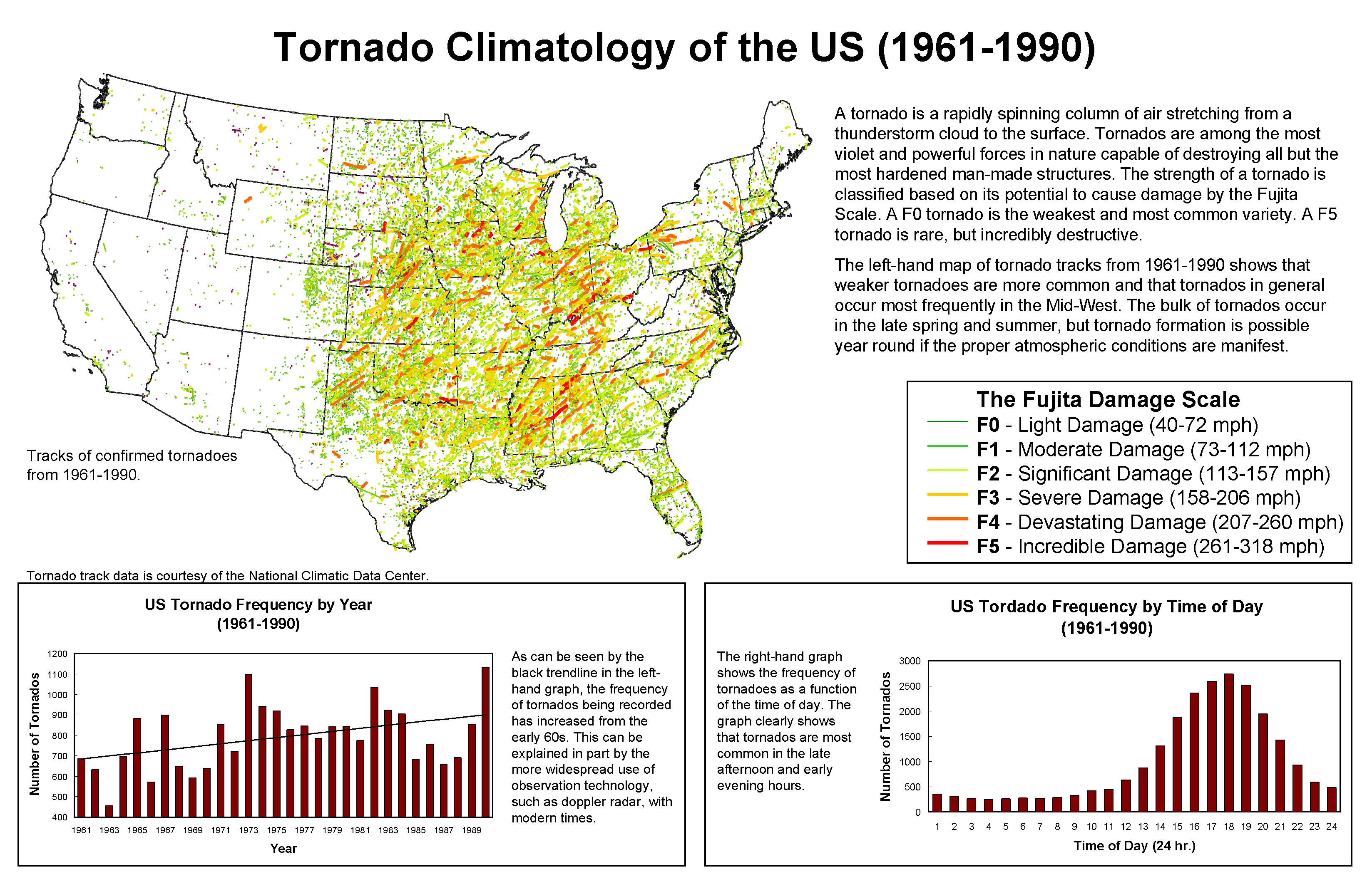
The above linked poster provides a brief description and climatology of tornadoes. The maps generated for this website where created using ArcGIS and make use of complex symbology and data provided courtesy of the NCDC.