NR 535 Assignments
NR 535 - Computer Cartography
Project 1 - Map Design for Print Publication
Professionals and academics in all fields are expected to publish their work in relevant professional journals. If this work has a spatial dimension (as it often does) maps will almost certainly play a major role in communicating its intent and outcome. Professional journals are limited venues for map publication, however, with maps restricted to small size and often without opportunity for color printing. The challenge of designing maps for journal publication lies in expressing complex cartographic messages with clarity and visual economy.
Specifications
Create a map suitable for publication in a professional journal or technical report. The choice of topic is entirely yours, but you may wish to choose a topic relevant to your own professional field or one of personal interest to you. Survey, architectural, and engineering drawings are generally not considered appropriate submissions for course projects.
Map format is 8.5" by 11.0" (letter or A4) but expect that it could be reduced to half that size for publication.
Design, produce (using ArcGIS or another computer mapping application), and submit two copies of your map; one at full size (100%) and another of exactly the same map reduced to half size (50%), i.e. half of the linear dimension. Your map should be optimized for black and white/ grayscale reproduction; the use of color is not permitted in this project.
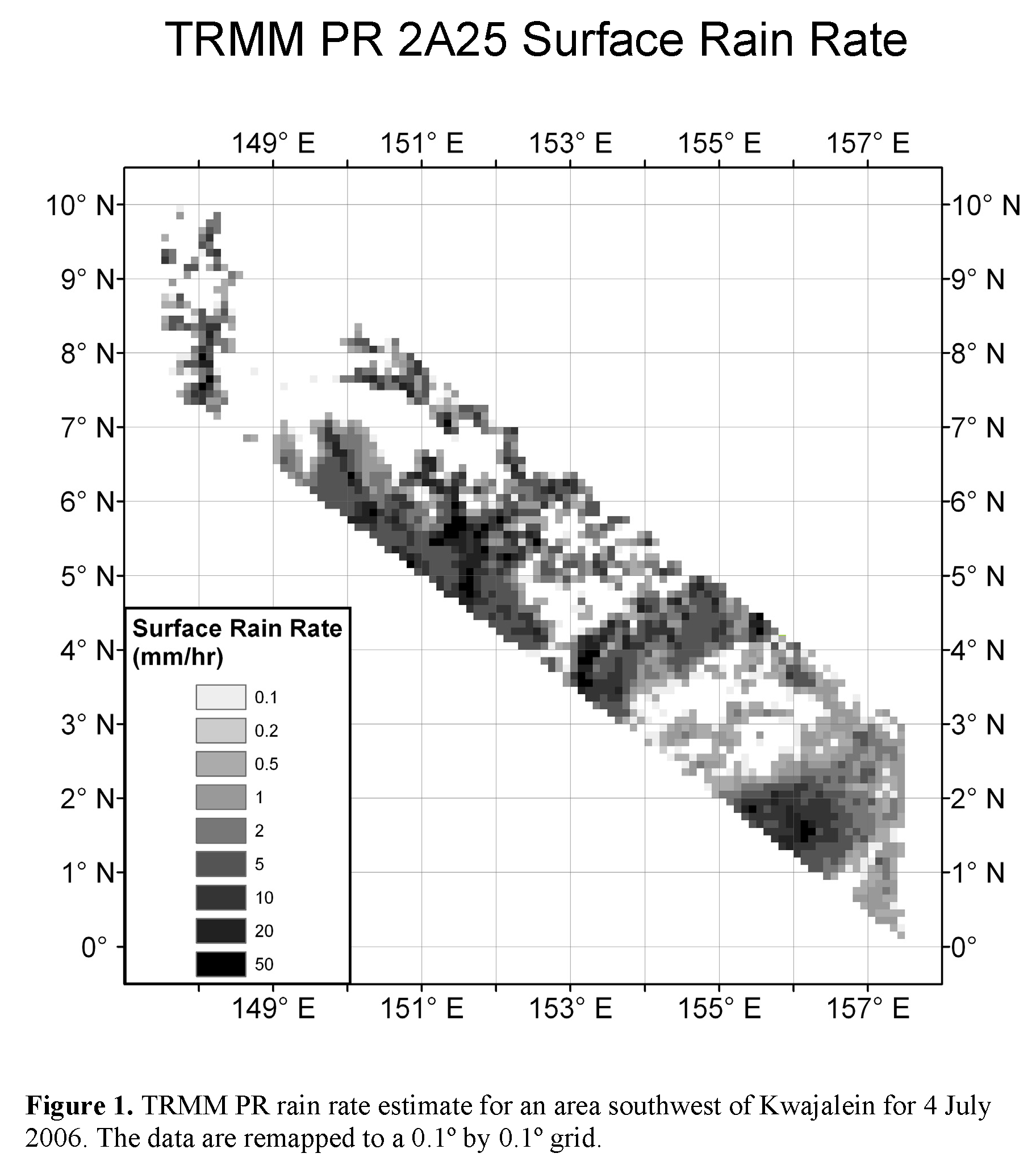
Click for fullsized image (1824x2060)
The above figure is a plot of a subset of rain rate data taken from a single orbit swath of data from the precipitation radar instrument on the Tropical Rainfall Measuring Mission (TRMM) satellite. The raw data consists of overlapping pixels with an approximately 4 km x 4 km footprint in a satellite relative coordinate system. The data was gridded in a 0.1° x 0.1° latitude/longitude based grid and projected using an equirectangular projection. The data for this figure was processed using NASA's TRMM orbit viewer and then exported into ArcGIS for plotting.